
SAN ANGELO, TX — Scattered light showers are expected across the region this morning, with heavier thunderstorms possible west of San Angelo later today, according to the National Weather Service office in San Angelo.
Forecasters said light rain this morning will likely total less than a tenth of an inch, but isolated storms could develop this afternoon and evening across areas stretching from Ozona to Sterling City to Anson and the Haskell line. The timeframe for these storms is roughly 5 p.m. to 9 p.m.
No severe weather is expected, but brief heavy rain, gusty winds, and dangerous lightning are possible.
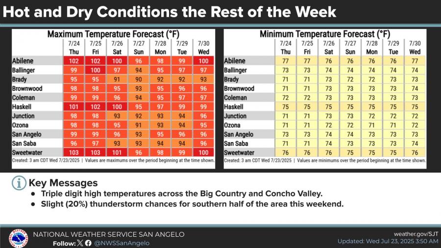
Meanwhile, a prolonged stretch of hot weather will build across the Big Country and Concho Valley through the weekend. High temperatures are forecast to reach triple digits Thursday and Friday, with values nearing 102 to 104 degrees across parts of the Big Country.
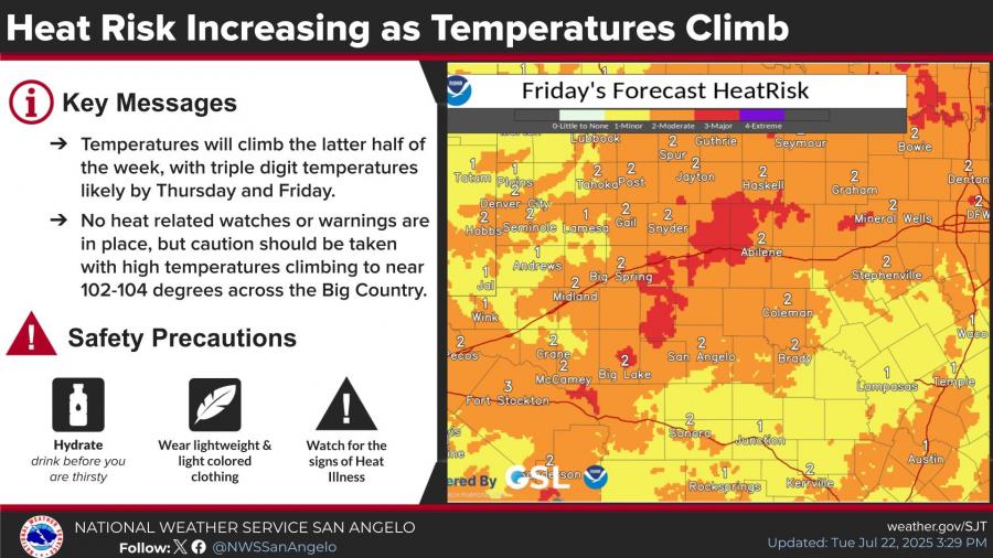
No heat advisories have been issued yet, but the NWS is urging caution due to the elevated heat risk. Overnight lows are expected to remain in the low to mid-70s.
San Angelo is forecast to reach 96°F Wednesday, 99°F Thursday, and 99°F Friday before a slight weekend cooldown. A 20 percent chance of storms is possible in the southern half of the region this weekend.


Subscribe to the LIVE! Daily

Required
Post a comment to this article here: