
SAN ANGELO, TX — The National Weather Service has issued a Severe Thunderstorm Watch for San Angelo and much of the region south of a San Angelo-to-Brownwood line, in effect until 10 p.m. Wednesday.
Counties under the watch include Tom Green, Brown, Coleman, Mason, Menard, McCulloch, San Saba, Schleicher, and Sutton, among others. Forecasters warn of large hail up to tennis ball size, damaging wind gusts reaching 70 mph, and the possibility of an isolated tornado.
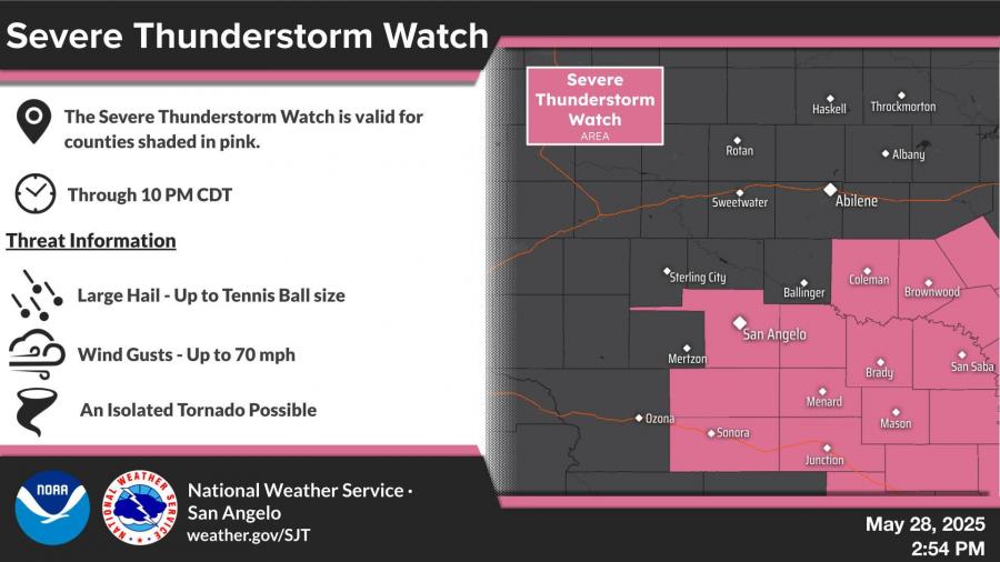
According to the NWS office in San Angelo, the greatest risk for severe storms will be during the afternoon and evening hours. Storms may form directly over the area rather than moving in from the west. In a public comment, the NWS noted that if storms do develop over San Angelo, the most likely timing would be after 4:30 p.m.
For updates, visit weather.gov/SJT.


Subscribe to the LIVE! Daily

Required
Comments
Listed By: Wiley Coyote
BRING IT!!
- Log in or register to post comments
PermalinkPost a comment to this article here: