
SAN ANGELO, TX — The National Weather Service has refined its forecast for severe weather across West Central Texas today, pinpointing the most likely window for dangerous storms between 3 p.m. and 7 p.m. Saturday.
San Angelo and surrounding communities remain under a slight risk for severe thunderstorms, classified as Level 2 out of 5. Hazards include very large hail—potentially up to baseball size—damaging winds exceeding 60 mph, and an isolated tornado.
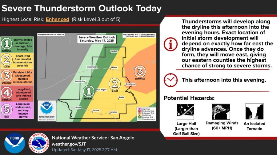
Storms are expected to begin forming along a dryline this afternoon, with the earliest activity possible as soon as 1 p.m. According to the NWS, development will begin in central and western counties before pushing eastward through the evening.
“These storms will be hit and miss and not everyone will see one,” the NWS San Angelo office posted Saturday morning. “But if you do, very large hail (larger than golf ball and perhaps something like baseball or larger) will be the main threat.”
A new set of hazard maps from the National Weather Service highlights:
-
Wind Threat: widespread across the region, including San Angelo.
-
Hail Risk: highest in the eastern Concho Valley and Heartland areas, such as Brownwood.
-
Tornado Potential: greatest east of San Angelo, particularly near Brownwood.


Forecasts for San Angelo predict a high near 97°F, with increasing clouds and a 30 percent chance of afternoon thunderstorms. South-southwest winds may gust as high as 25 mph.
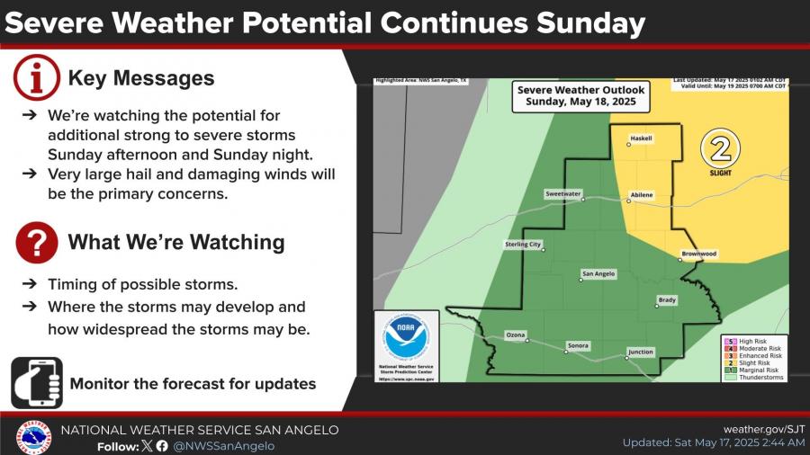
The severe weather threat does not end today. The NWS also forecasts a slight risk for additional severe storms on Sunday afternoon and evening, although uncertainty remains about storm coverage. Large hail and strong winds will again be the primary concerns.


Subscribe to the LIVE! Daily

Required
Post a comment to this article here: