
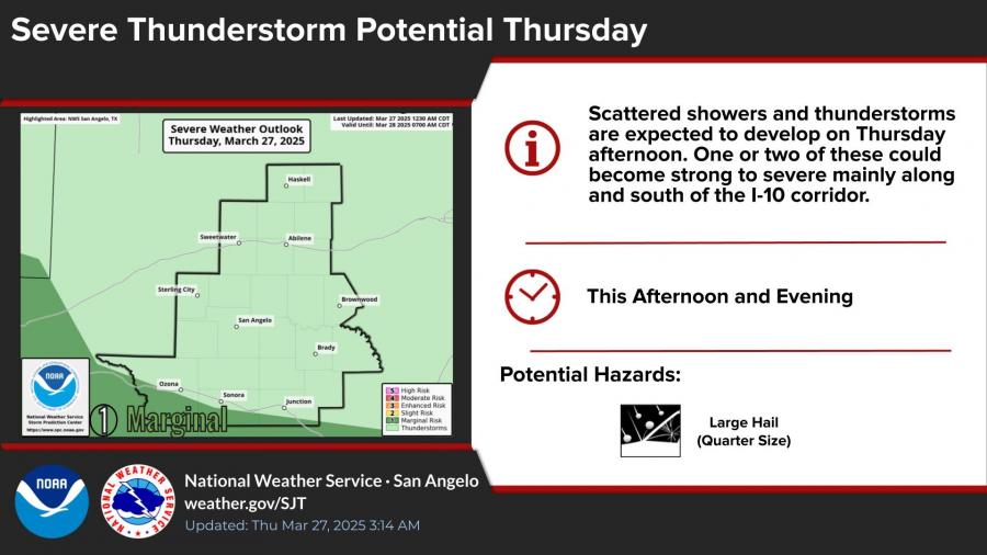
SAN ANGELO, TX — Rain and thunderstorm chances that looked promising have now decreased for San Angelo, with forecasters now projecting only a 35% chance of rain Thursday afternoon and evening. Most of the severe weather potential remains south and southeast of the city.
According to the National Weather Service, showers and isolated thunderstorms are still possible through Friday, but the highest rain chances and rainfall totals will be concentrated near the I-10 corridor. Those areas face the possibility of quarter-size hail, gusty winds up to 55 mph, and locally heavy rainfall.

Rainfall amounts for the region are expected to range from a quarter to three-quarters of an inch. Some areas may receive less than a quarter inch, while isolated storms could produce higher totals.
San Angelo is not included in the marginal risk zone for severe storms, and any precipitation that does fall is likely to be short-lived.
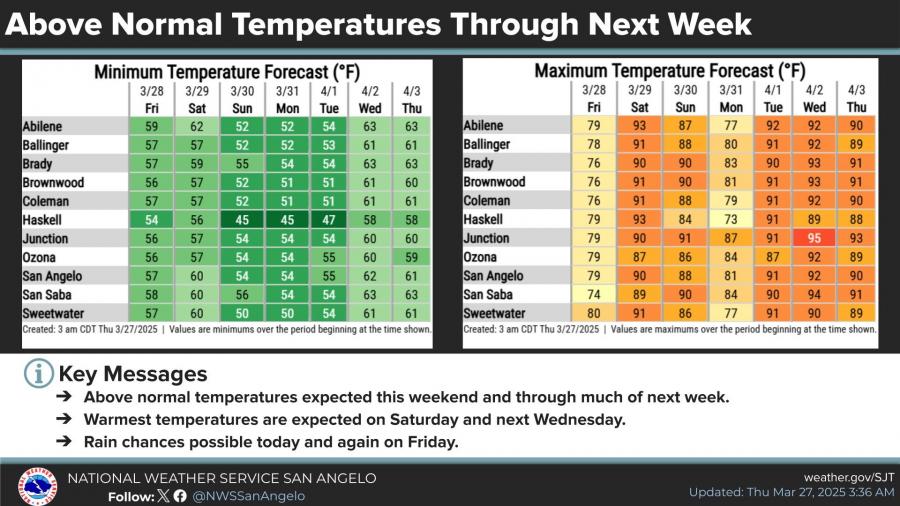
Temperatures will remain above normal into next week. A high near 71 degrees is forecast for Thursday, with highs climbing into the upper 80s and low 90s over the weekend and early next week.


Subscribe to the LIVE! Daily

Required
Post a comment to this article here: