
SAN ANGELO, TX – West Central Texas will see increased chances for rain and thunderstorms from Wednesday evening through Friday, according to the National Weather Service in San Angelo.
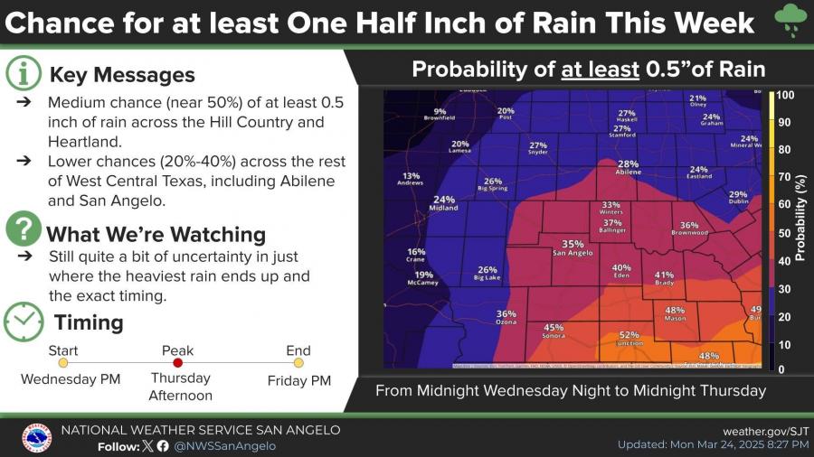
The highest chance for measurable rain — at least 0.5 inches — is forecast in the Hill Country and southern parts of the Concho Valley. San Angelo has a 35% probability of receiving that amount, while areas like Junction and Mason could see chances as high as 52% and 48%.
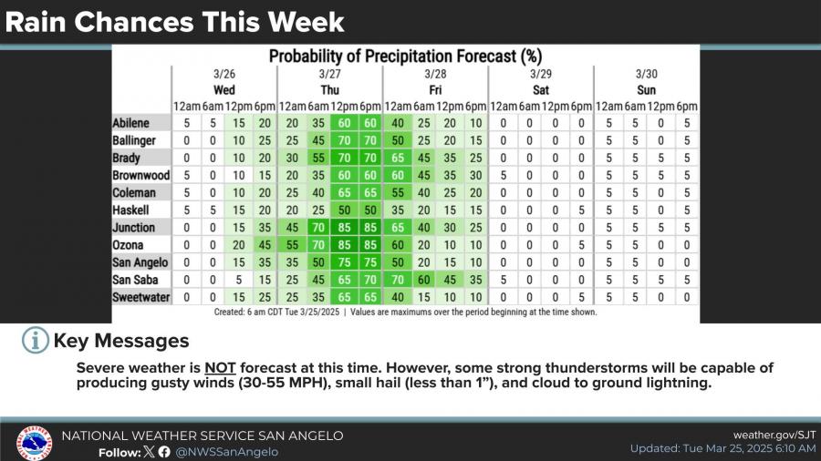
Rainfall is expected to begin late Wednesday, with peak activity Thursday afternoon and tapering off by Friday evening. While severe weather is not forecast, the NWS warns that isolated thunderstorms could bring gusty winds up to 55 mph, small hail, and lightning.
San Angelo has a 75% chance of precipitation during the day on Thursday, with the likelihood decreasing to 15% by noon on Friday.
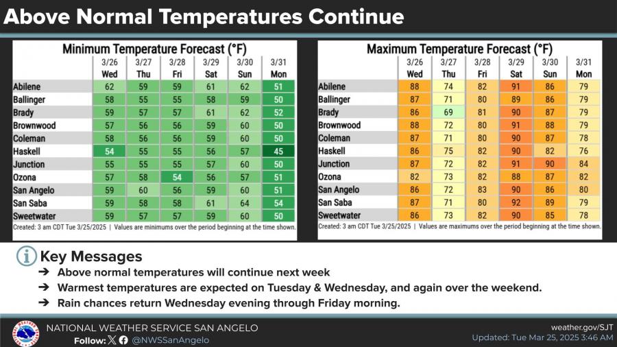
Meanwhile, above-average temperatures will continue through the weekend. Highs are expected to reach the upper 80s and lower 90s Tuesday and Wednesday, with another warmup into the weekend. San Angelo’s forecast high Tuesday is 91 degrees, just shy of the March 25 record of 94 set in 2018.
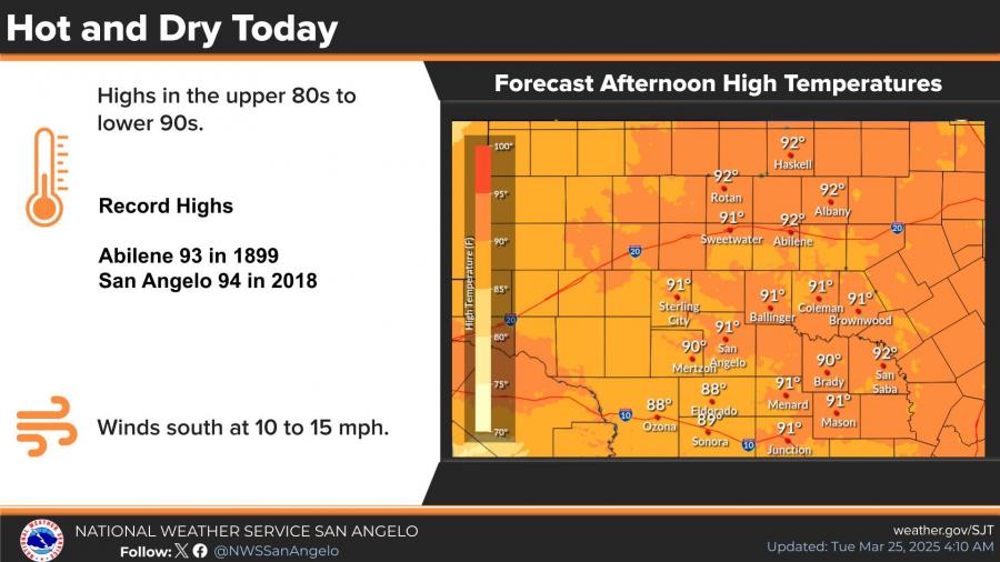
Winds will be out of the south at 10 to 15 mph.


Subscribe to the LIVE! Daily

Required
Post a comment to this article here: