
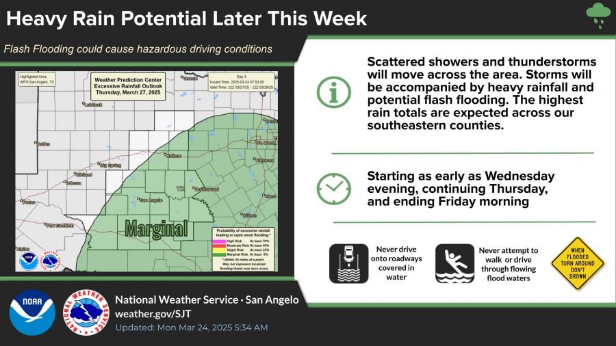
SAN ANGELO, TX – Scattered thunderstorms could bring flash flooding to parts of West Central Texas later this week, with the highest rain totals expected in our southeastern counties, according to the National Weather Service in San Angelo.
The risk for excessive rainfall is currently classified as marginal. Forecasters say storms could begin as early as Wednesday evening and continue through Friday morning. Periods of heavy rainfall may lead to hazardous driving conditions, especially in flood-prone areas.
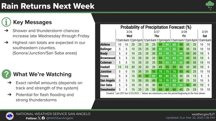
Rain chances for San Angelo increase Thursday and Friday, with the highest probability of precipitation expected Thursday night into early Friday. While exact rainfall totals remain uncertain, forecasts suggest a low to medium chance of more than one inch of rain in the area.
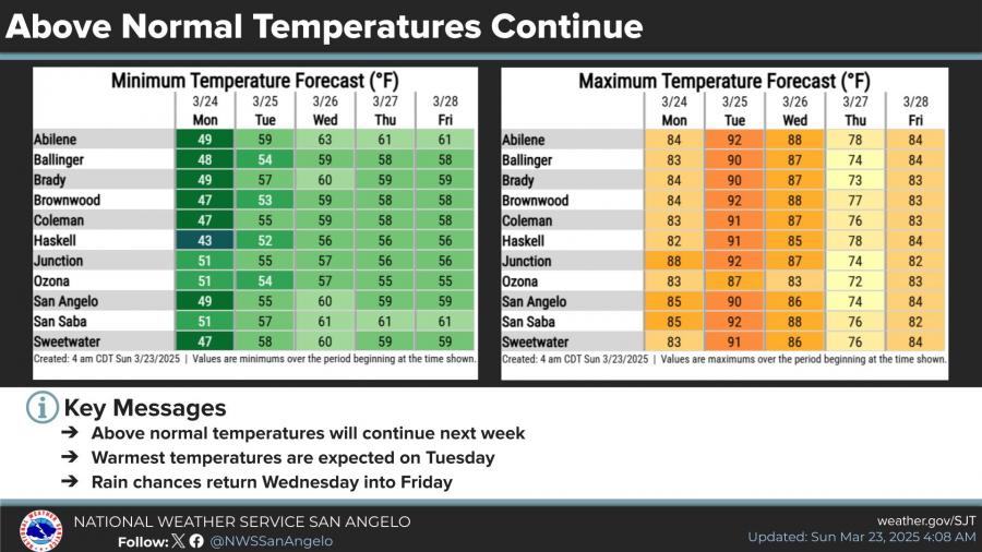
In addition to the rain, above-normal temperatures are expected to continue throughout the week. Highs will peak Tuesday in the upper 80s to low 90s before dropping into the 70s later in the week as rain chances rise.


Subscribe to the LIVE! Daily

Required
Post a comment to this article here: