
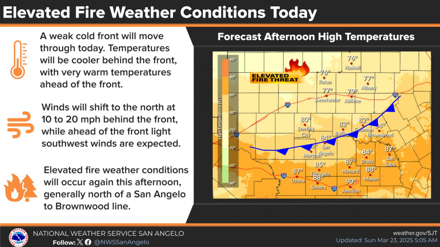
SAN ANGELO, TX — The National Weather Service is warning of elevated fire weather conditions across the Concho Valley today, especially north of a San Angelo-to-Brownwood line, as a weak cold front moves through the region.
The front is expected to bring breezy north winds between 10 and 20 mph and much drier air. Afternoon highs will reach the mid-80s in San Angelo, but areas ahead of the front could see even warmer temperatures nearing 90 degrees, especially in places like Junction and Sonora. Southwest winds will shift to the north behind the front by the afternoon.
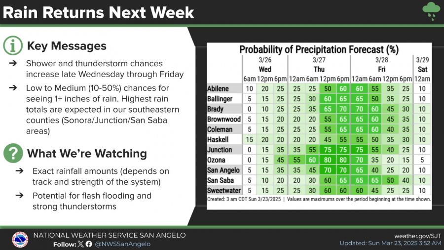
Meanwhile, weather conditions are expected to shift by late Wednesday as rain and thunderstorm chances return to the forecast. The San Angelo area has a 35 percent chance of showers Wednesday night, increasing to 70 percent Thursday afternoon and evening. Rainfall totals of up to three-quarters of an inch are possible.
Forecast models show the highest rainfall totals are likely in southeastern counties such as Sonora, Junction, and San Saba. The chance for showers continues into Friday, with a 40 percent chance before the system moves out ahead of the weekend.
Winds throughout the week will remain mostly calm, ranging from 5 to 10 mph, shifting from the south by Monday. Highs will fluctuate from the mid-80s early in the week to the mid-70s Thursday before rebounding into the upper 80s by Saturday.
Forecasters are monitoring the potential for flash flooding and strong thunderstorms depending on the track and strength of the approaching system.

")

Subscribe to the LIVE! Daily

Required
Post a comment to this article here: