
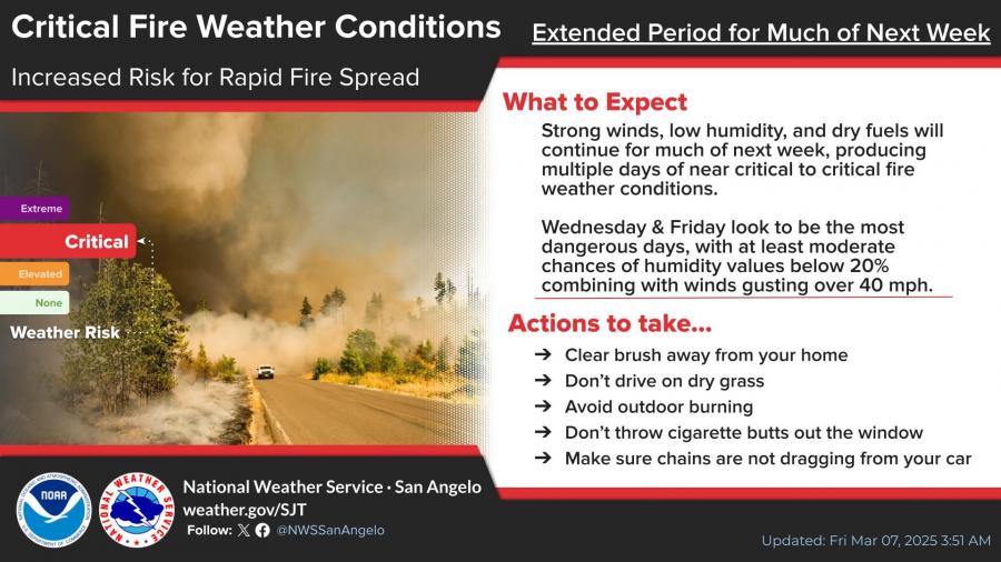
SAN ANGELO, TX — The National Weather Service warns of critical fire weather conditions next week as strong winds, low humidity, and dry fuels create an increased risk for rapid fire spread across West Central Texas.
The most dangerous days are expected to be Wednesday and Friday, with humidity levels dropping below 20% and wind gusts exceeding 40 mph. Officials urge residents to clear brush around homes, avoid outdoor burning, and ensure chains are not dragging from vehicles to prevent sparks.
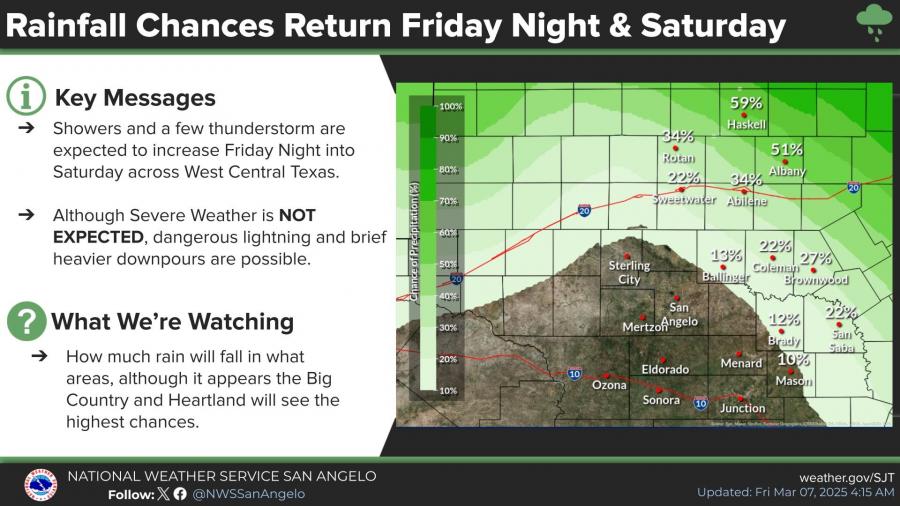
Meanwhile, a chance of rain returns this Friday night into Saturday, with showers and isolated thunderstorms expected. Though severe weather is not anticipated, NWS cautions that brief heavy downpours and lightning are possible, with the highest rainfall chances in the Big Country and Heartland regions.
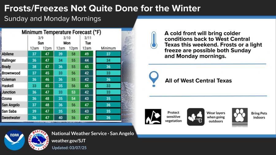
Temperatures will drop significantly by Sunday morning as a cold front moves in, bringing the potential for frost or a light freeze across much of West Central Texas. Lows in the mid-30s are expected in San Angelo and surrounding areas on both Sunday and Monday mornings. Residents are advised to protect sensitive vegetation, wear layers when outdoors, and bring pets inside. The high temperature on Sunday will peak in the mid-60s. The highs on Saturday will peak near 60 degrees. Today, expect high temperatures to be in the low 80s.


Subscribe to the LIVE! Daily

Required
Post a comment to this article here: