
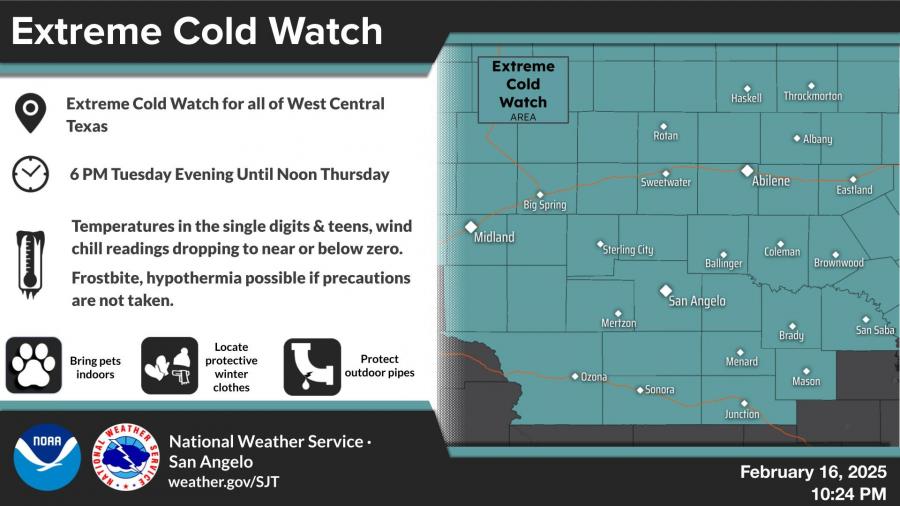
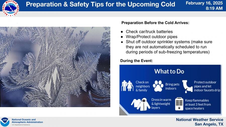
SAN ANGELO, TX – A strong cold front is expected to bring dangerously cold temperatures and wind chills to West Central Texas this week, with an Extreme Cold Watch in effect from 6 p.m. Tuesday until noon Thursday.
According to the National Weather Service in San Angelo, overnight lows will fall into the single digits and teens, with wind chill values dropping to near or below zero. Frostbite and hypothermia are possible without proper precautions.
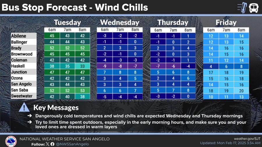
Bus Stop Forecast: Dangerous Wind Chills
Children waiting at bus stops Wednesday and Thursday mornings are at risk for extreme cold exposure. Wind chill values are forecast to range from -5°F to -9°F in some areas, including Haskell and Brownwood.
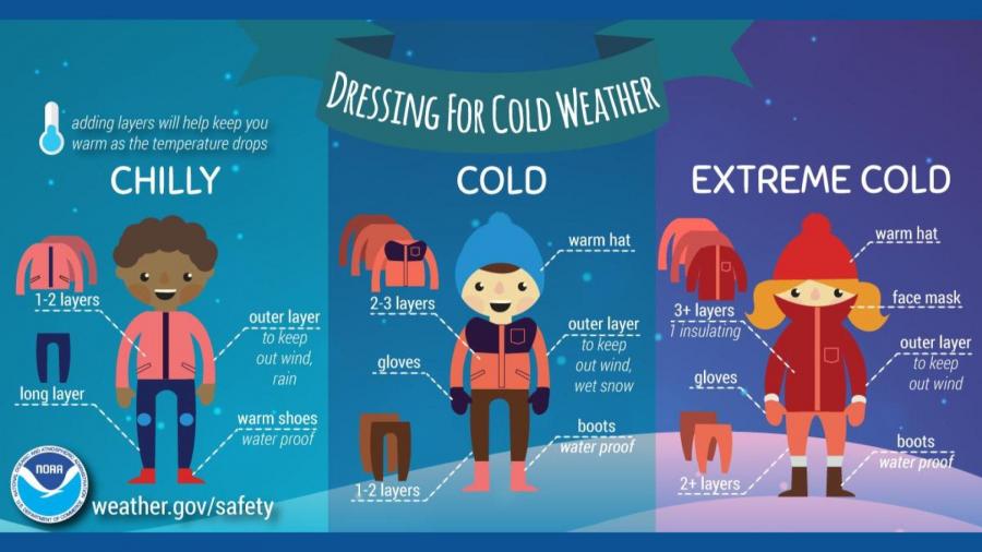
Officials urge residents to limit time outdoors, dress in layers, and ensure pets and outdoor pipes are protected.
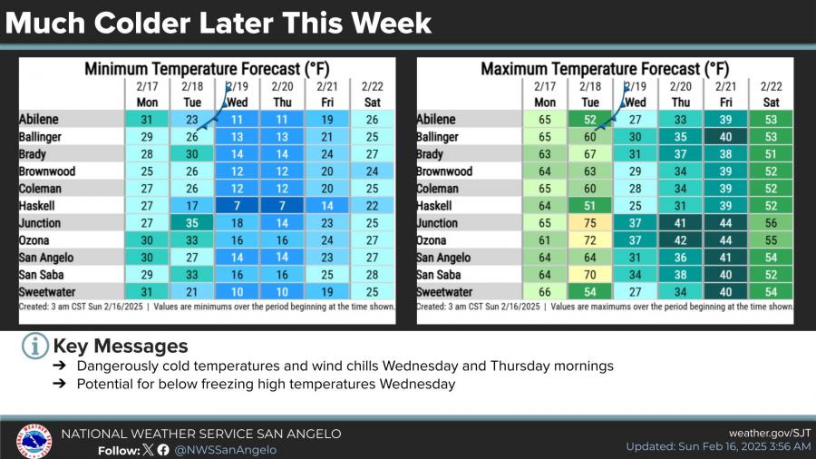
Cold Front Timeline & Temperature Drops
- Monday: Mild conditions with a high near 64°F, light winds in the morning increasing to gusts up to 25 mph in the afternoon. Lows will be around 48°F.
- Tuesday: Highs in the 60s before the front moves in overnight.
- Wednesday: Lows in the teens with highs struggling to reach freezing.
- Thursday: Continued bitter cold with sub-zero wind chills in the morning.
- Friday: Gradual warming, with lows in the teens and highs in the upper 30s.
Safety Preparations:
- Check vehicle batteries
- Wrap and protect outdoor pipes
- Let indoor faucets drip
- Keep pets indoors
- Dress in multiple layers, including gloves and hats


Subscribe to the LIVE! Daily

Required
Post a comment to this article here: