SAN ANGELO, TX – Freezing rain, ice accumulation, and snowfall are expected to create hazardous travel conditions across West Central Texas starting Wednesday afternoon through Thursday, according to the National Weather Service in San Angelo.
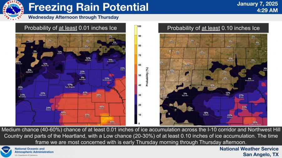
A medium chance (40-60%) of at least 0.01 inches of ice is forecast for the I-10 corridor, Northwest Hill Country, and parts of the Heartland, with lower chances (20-30%) of ice accumulation reaching 0.10 inches. The most concerning timeframe for icy conditions is from early Thursday morning through Thursday afternoon.
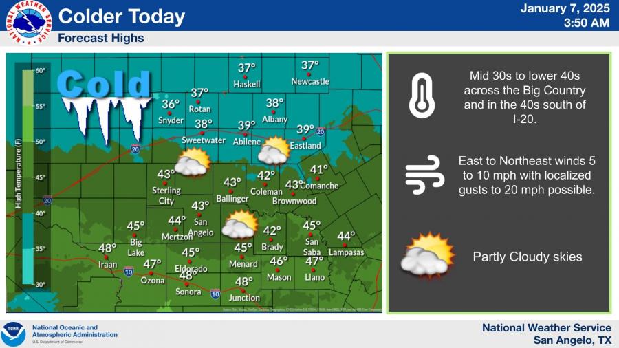
Temperatures across the region are expected to remain below freezing during the mornings and struggle to reach the low 30s to low 40s during the day. Highs for today are forecast to be in the mid-30s to lower 40s, with slightly warmer conditions in the low 40s south of I-20.
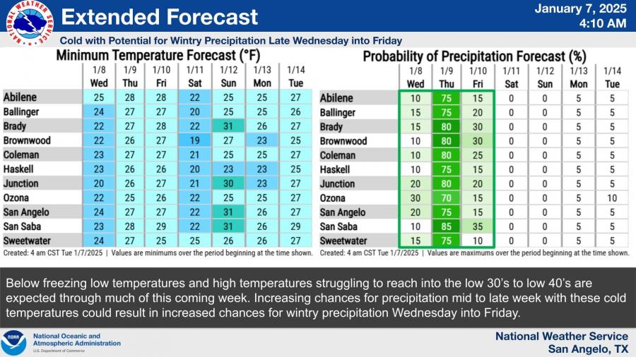
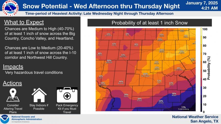
The extended forecast shows increasing chances for wintry precipitation mid-to-late week, with significant snowfall possible. There is a medium to high chance (40-70%) of at least 1 inch of snow across the Big Country, Concho Valley, and Heartland. Northwest Hill Country and areas along the I-10 corridor face a lower chance (20-40%) of the same snowfall totals.
These conditions are expected to create very hazardous travel conditions, especially during the heaviest snowfall, predicted late Wednesday night through Thursday afternoon.
The NWS advises residents to consider altering travel plans, stay indoors if possible, and pack an emergency kit if travel is necessary.
Subscribe to the LIVE! Daily
Required




Post a comment to this article here: