SAN ANGELO, TX – Residents of West-Central Texas can expect warmer-than-usual temperatures throughout the week, according to the National Weather Service.
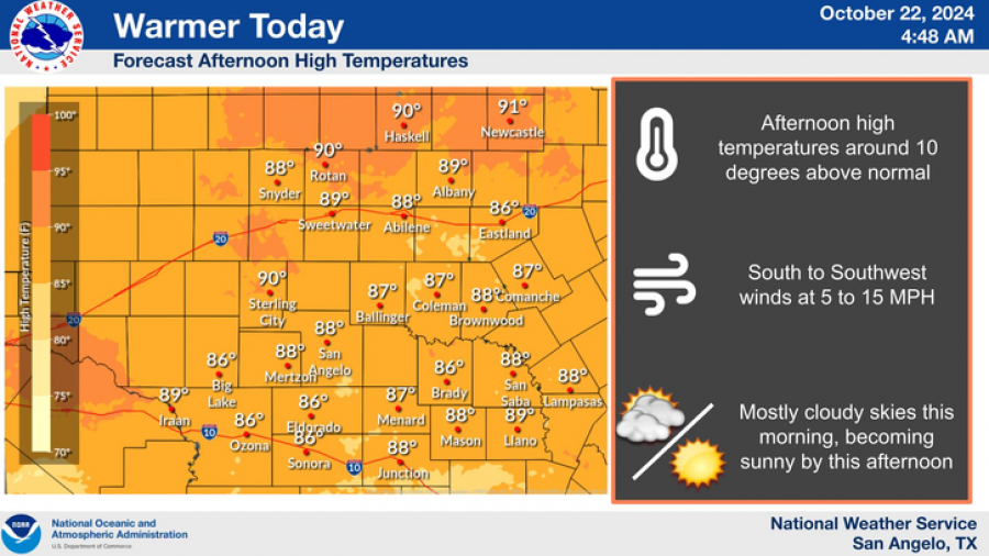
Highs are forecasted to reach the mid-80s to low 90s, with afternoon temperatures averaging around 10 degrees above normal for this time of year. Today, partly cloudy skies in the morning will give way to sunny conditions by noon, with temperatures peaking near 88°F in San Angelo.

National Weather Service
Winds will blow from the south-southwest at 5 to 10 mph. Overnight, mostly clear skies are expected, with a low around 61°F and light winds.
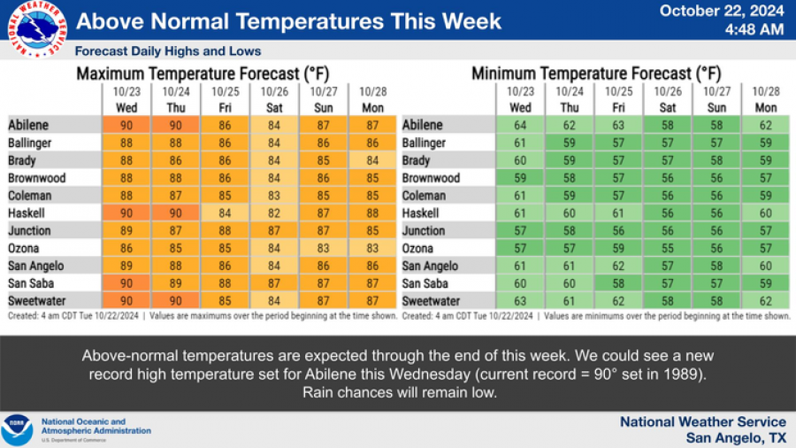
The warmer pattern will persist through the week. Wednesday’s high will reach 90°F under clear skies, while Thursday and Friday will remain sunny with highs in the upper 80s. Overnight lows will hover in the upper 50s to low 60s. Rain chances remain minimal, and south-southwest winds will range from 5 to 15 mph, with gusts up to 20 mph on Thursday.

National Weather Service
Above-normal temperatures are expected to continue through the weekend, with highs nearing 87°F on Sunday. Low temperatures will stay mild, ranging from 57°F to 61°F.
The forecast indicates a potential new record high temperature for Abilene on Wednesday, challenging the previous record of 90°F set in 1989. Despite the heat, rain chances remain low for the foreseeable future.
Subscribe to the LIVE! Daily
Required


Post a comment to this article here: