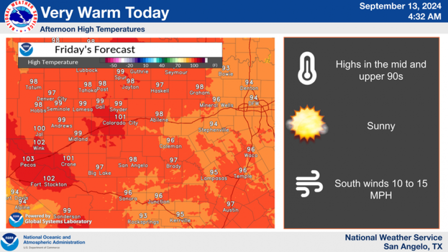
SAN ANGELO, TX - San Angelo is expected to experience hot and sunny conditions this weekend, with temperatures rising to near 100 degrees, according to the National Weather Service.
The heatwave will peak with highs of 99°F on both Saturday and Sunday.
Today’s forecast shows a high of 98°F, with south winds between 5 to 10 mph and gusts up to 20 mph. Tonight, clouds are expected to increase with lows around 75°F, accompanied by south winds of 5 to 10 mph.
National Weather Service
Saturday will bring partly sunny skies with a high near 99°F. Winds will shift slightly to the southwest, reaching 10 mph, and gusts of up to 20 mph are possible. Saturday night will be partly cloudy, with lows around 72°F and calm winds at 5 mph.
The trend of hot weather will continue through Sunday, with the forecast predicting sunny skies and a high of 99°F once again. Winds will remain steady at 5 to 10 mph from the south-southwest. Sunday night is expected to be mostly clear, with a low of around 71°F.
The National Weather Service warns that these temperatures are about 5 to 10 degrees above normal for this time of year, marking a return to summer-like conditions after a brief taste of fall over the past two weeks.
National Weather Service
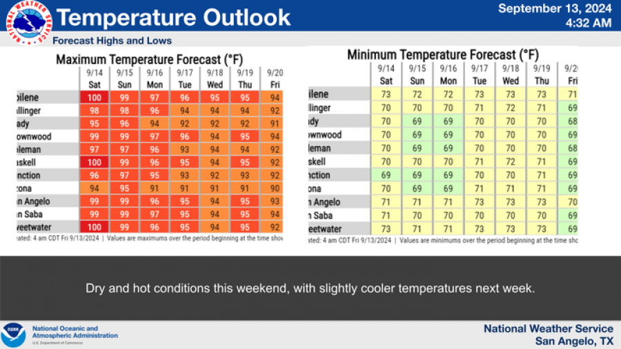
Dry and hot conditions are expected to persist into early next week, with slightly cooler temperatures forecasted by mid-week.
Subscribe to the LIVE! Daily
Required





Post a comment to this article here: